A global tool against deforestation
In the pursuit of a positive CO2 balance, companies are striving to procure raw materials from sustainable sources. Yet, how can food companies ensure that deforestation in the areas of cultivation is avoided? ETH researchers are developing a global tool that all companies can use.
In the following interview, Dr. Jan Dirk Wegner and Nico Lang from the EcoVision Lab give an insight into their research project with industrial partner Barry Callebaut.
What are the strategies to make supply chains (e.g. for cocoa) sustainable and to avoid deforestation?
The ultimate goal is to ensure that regions with high biomass, biodiversity (such as rainforest), and any traditional use by the local population are not deforested for cultivation on any account. In regions with low biomass, however, plantations are possible. This approach is promoted under the guidance of Greenpeace as the High Carbon Stock Approach (HCSA) and is supported by a consortium of leading cultivation and processing companies (such as Barry Callebaut, Nestle).
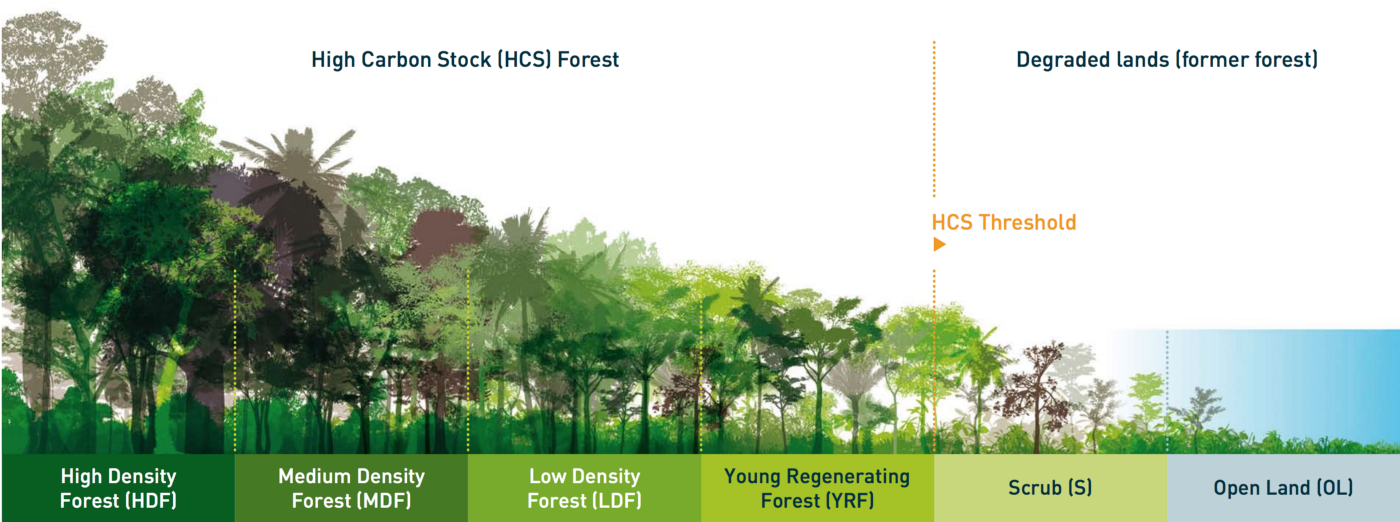
The difficulty is to obtain up-to-date data on the vegetation. Many companies employ sustainability teams to collect information on site, but this information is very patchy and often not transparent. Existing measuring methods such as flying over large areas by plane and carrying out laser scanning are very costly and therefore limited in terms of range.
In what way is your approach new?
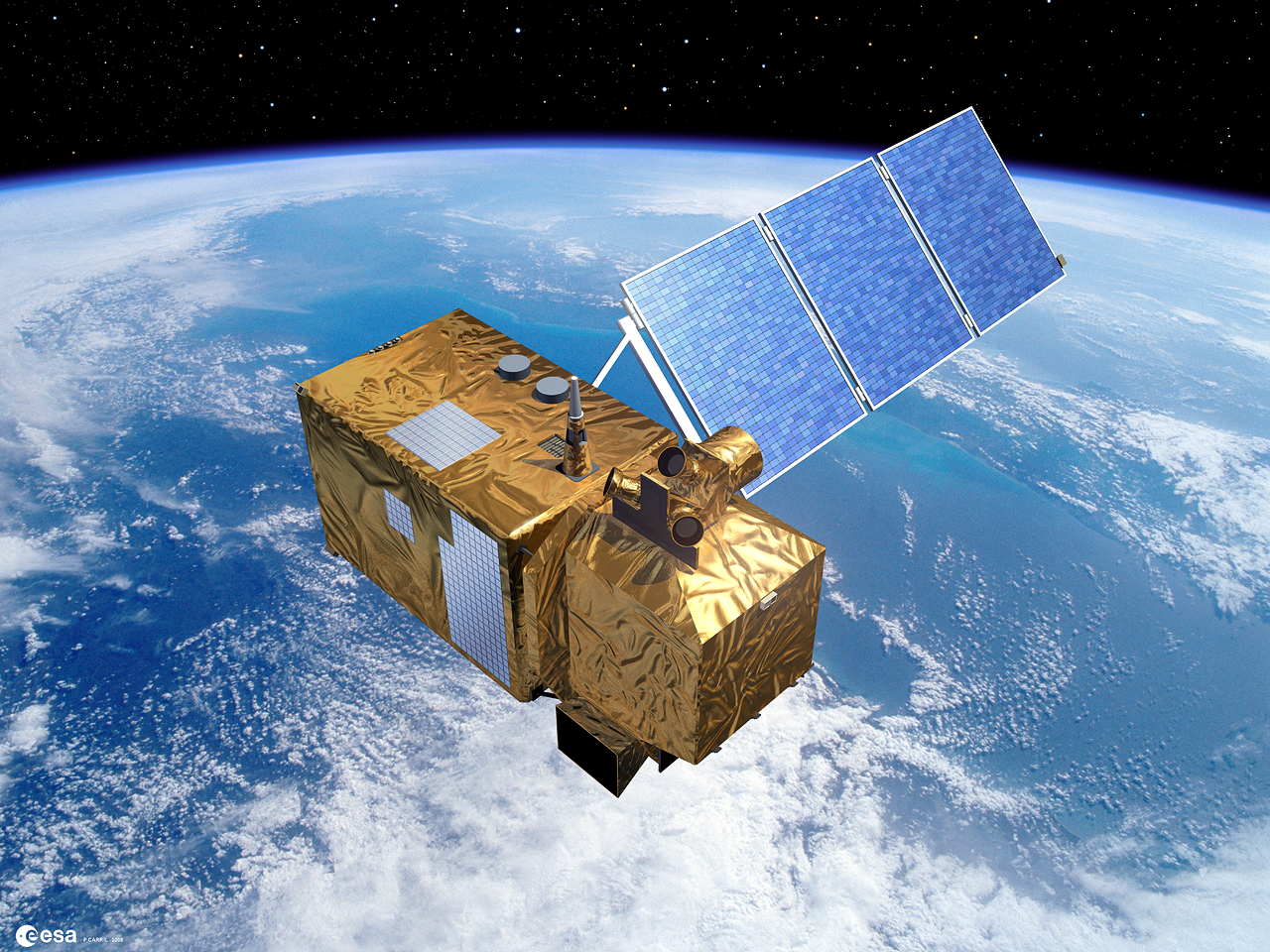
We use satellite imagery (such as from Sentinel-2). These images have the advantage of being available globally with a high temporal and spatial resolution. Sentinel-2 delivers images of the whole world every 5 days with a resolution of up to 10 m. By having many images of one place at a time, clouds obscuring the view can be eliminated, even in tropical areas.
Drawing conclusions about the vegetation characteristics from the satellite images is not that easy, is it?
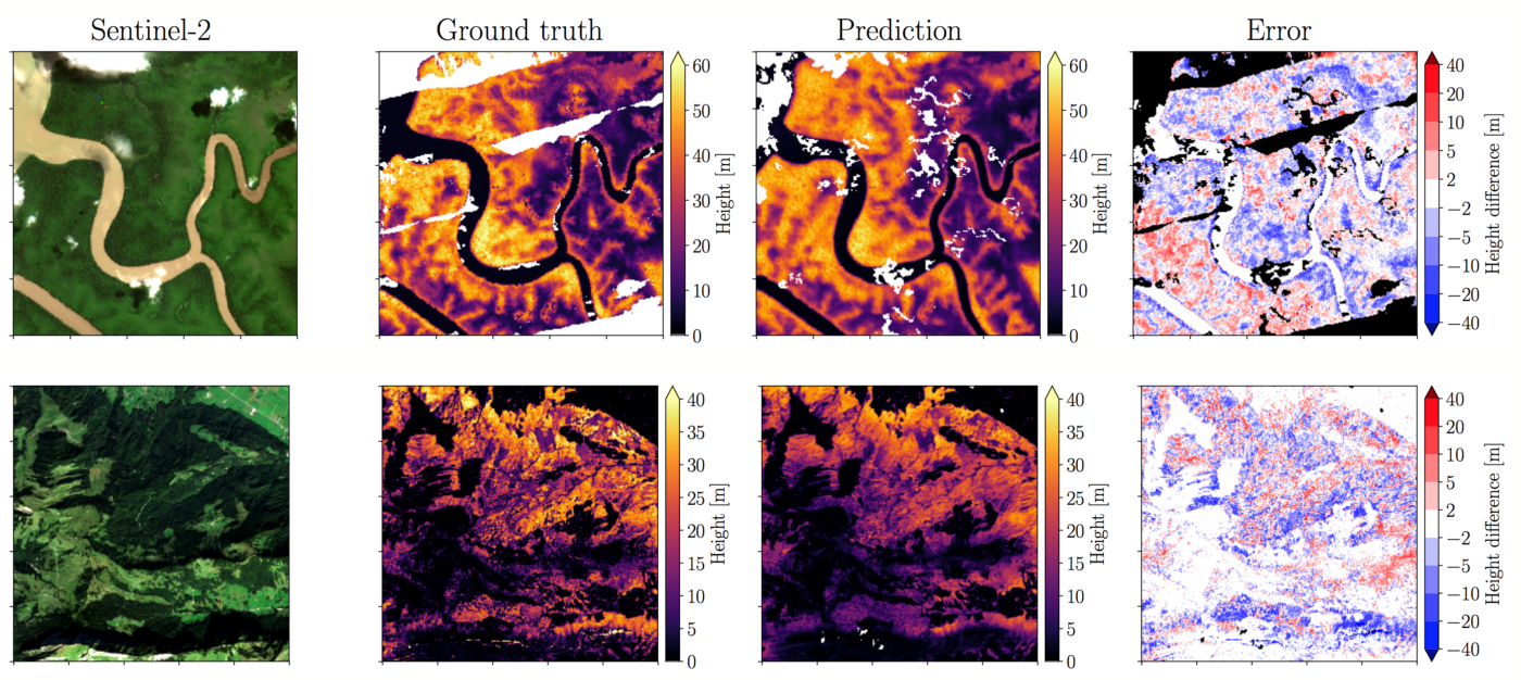
Image evaluation alone will not get you there. However, by combining satellite data and applying innovative data-driven algorithms (keyword: machine learning) we can achieve amazing results.
The first step is to estimate the height of vegetation. We try to extract the 3D information from 2D images by using just one viewpoint. We are familiar with this kind of problem for instance from autonomous driving (monocular depth estimation) and we transfer the methods to optical satellite images.
In a second step, we are working with NASA to use laser scanner data from space collected by the ISS to draw conclusions about the biomass. The advantage of the laser is that reflection data from the leaf canopy to the ground can be obtained in 3D and thus conclusions can be drawn about the vegetation height and biomass. The disadvantage is that the laser measuring points are not as dense. We use the laser data as reference data and combine them with the optical satellite images to create a high-resolution map. We follow a deep learning approach, i.e. our algorithm is fed with lots of training data and learns the correlations.
What results did you obtain?
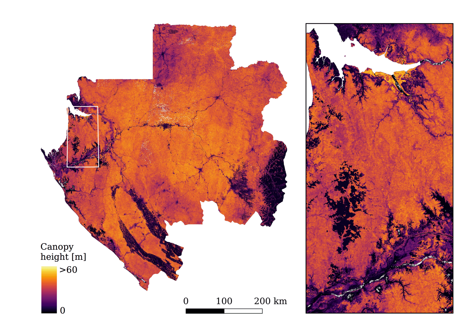
We have already created maps for entire countries (Gabon, Switzerland) with a spatial resolution of 10 m and an accuracy of the estimated vegetation height of ± 5 m. Ultimately, we would like to generate such a high-resolution biomass map for the whole world and make it publicly available, also to companies.
When and in what form will the global map be available?
We plan to complete the project within the next two years and then, in cooperation with the HCSA consortium, publish an online tool to which all companies will have access at a reasonable cost. The aim is to provide objective and transparent information as opposed to the current patchy and subjective situation. All companies can then work with the same reliable data.
These results are bound to be of interest to other industries as well.
Yes, absolutely. Many countries are interested in our map, for example to use it for spatial planning and to pursue sustainable development strategies. In addition, our data is also very interesting for climate research, of course.
Contact / Links:
More information is available on the project website.
external pageHigh Carbon Stock Approach (HCSA)
Publications:
Lang, N., Schindler, K., & Wegner, J. D. (2019). external pageCountry-wide high-resolution vegetation height mapping with Sentinel-2. Remote Sensing of Environment, 233, 111347.
Do you want to get more "News for Industry" stories?
external pageSubscribe to our newsletter
external pageFollow us on LinkedIn
Are you looking for research partners at ETH Zurich?
Contact ETH Industry Relations