Using radar to study glaciers
ETH researchers are using radar to scan the snow and ice on the Jungfraujoch. Sometimes, scaling an icy peak is the only way for scientists to fully understand satellite data.
With mist obscuring the sun, and powerful gusts of wind whipping up flurries of snow, everything merges into a white blur. The sun may be hidden, but its harsh glare still forces the eyes into a squint. Without sunglasses, it’s almost impossible to see.
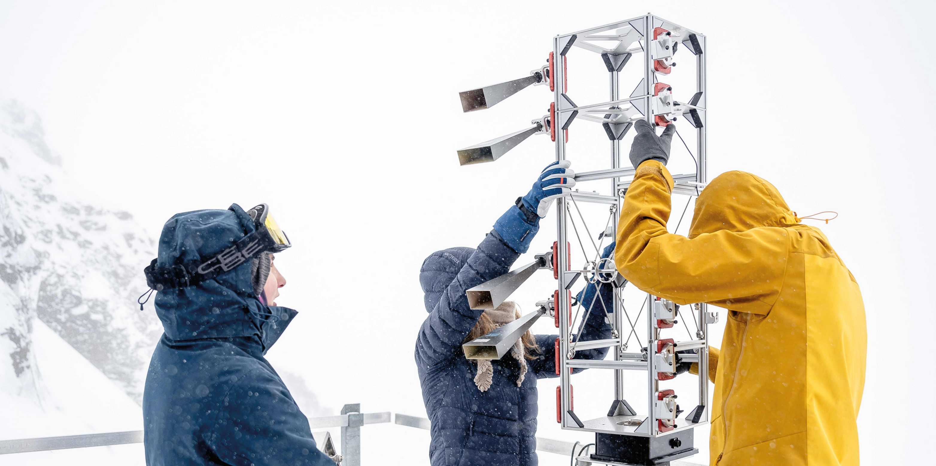
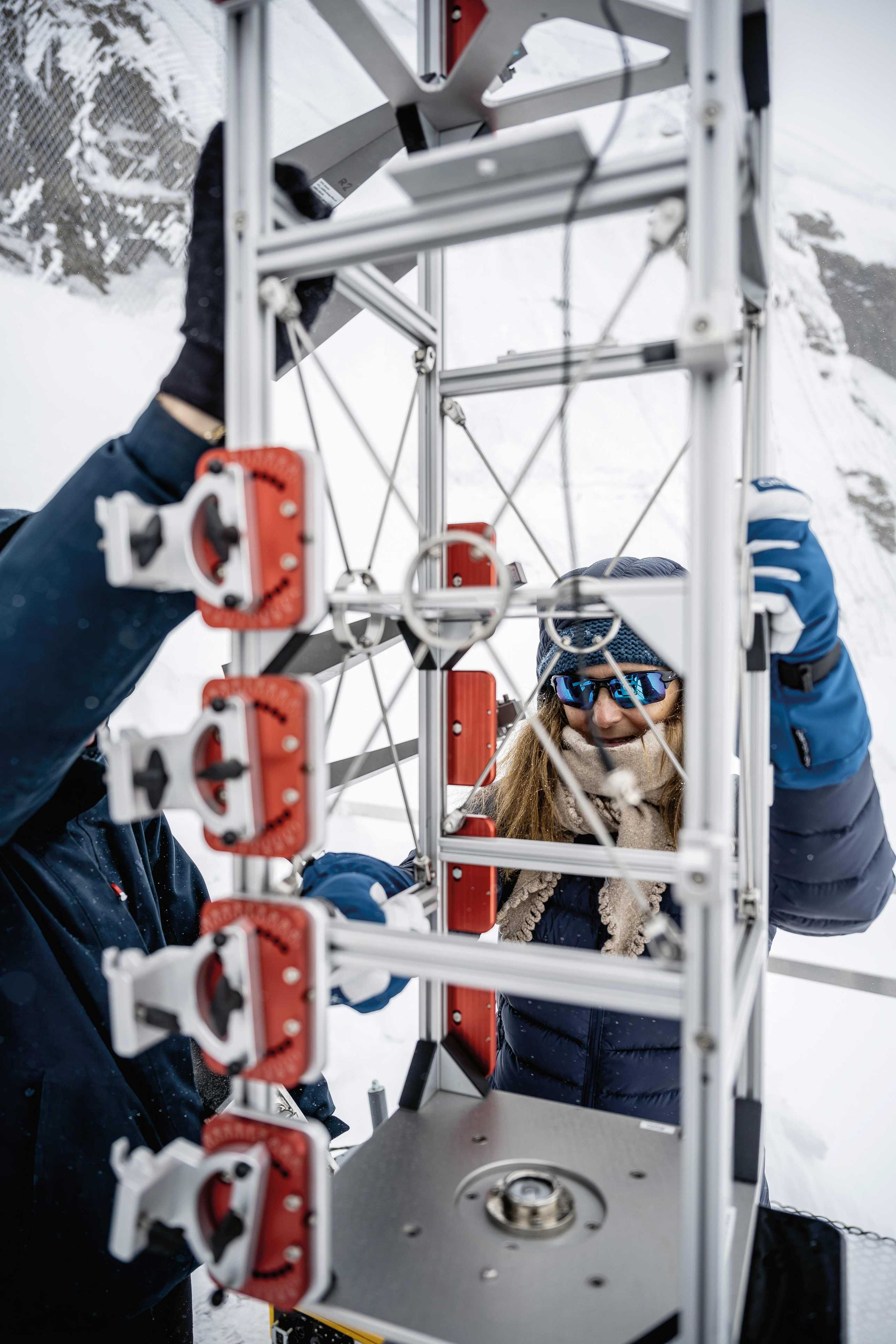
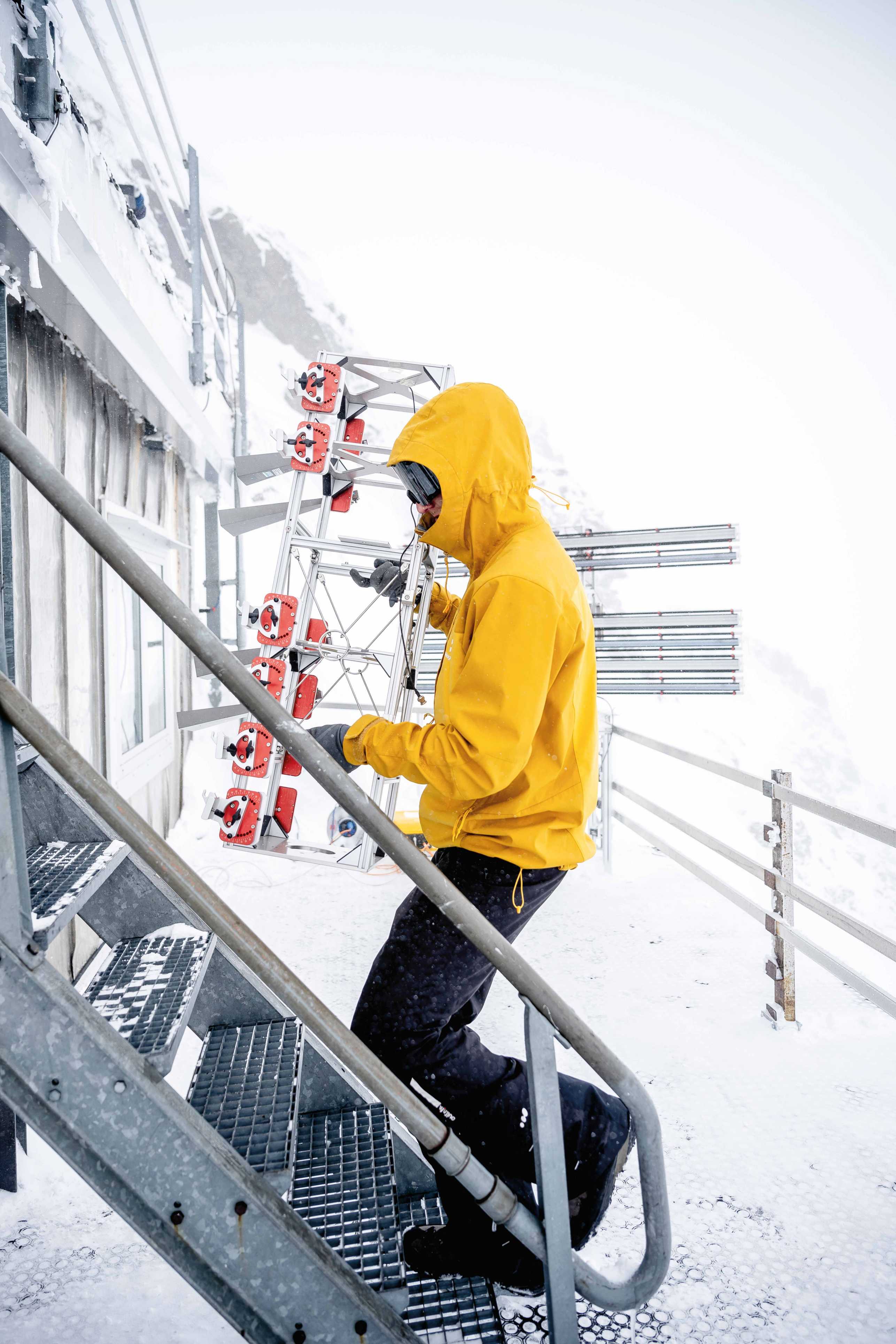
Eager to exploit a sudden lull in the wind, ETH researchers Marcel Štefko and Esther Mas i Sanz, as well as their professor Irena Hajnsek, hurry to set up two radar antennas. The spots they have chosen are three stories above their lodgings in the High Altitude Research Station Jungfraujoch, one on the upper terrace, and one on the lower terrace. The researchers have spent the whole morning waiting for the weather to clear up – and now there’s no time to lose.
Somewhere in the white glare below is the Aletsch Glacier, though not a trace of it is visible. “Fortunately, that’s not a problem for radar! It can see the glacier through any amount of mist or clouds,” says Štefko. As he talks, he hooks up the radar antenna to a computer, which is safely stowed in a yellow plastic box to protect it from the snow and ice. “Strong winds are bad news, though,” he adds. “They make the antennas wobble, which can reduce the accuracy of our measurements.”
Measuring ice loss
For several years, ETH researchers have made their way up to the High Altitude Research Station Jungfraujoch to study the upper part of the Aletsch Glacier using a variety of radar technologies and systems. These visits also serve to develop new methods and to gather reference data for satellite radar systems.
The researchers use this data for various purposes, including the creation of topographic maps known as digital elevation models. Based on these representations of the Earth’s surface, the researchers can determine the topography of the Aletsch Glacier and calculate the shrinkage of the glacier over time.
“The radar data clearly shows a huge drop in the glacier’s mass over recent years, at an average rate of 2.5 metres a year,” says Hajnsek, who specialises in remote sensing.
Even if the ice only shifted a few millimetres, the ETH radar systems would still be sensitive enough to detect it. “Our measurements show that the glacier is moving at a rate of 8 to 12 millimetres an hour, which is somewhere between 20 and 30 centimetres a day,” says Mas i Sanz, a doctoral student who is currently on her third Jungfraujoch measurement campaign. But this figure varies significantly from one location to the next: up here at the top of the glacier, the ice is still moving relatively slowly, but in other parts not covered by the radar, the Aletsch Glacier is slipping towards the valley at an average rate of 80 centimetres a day.
Glacier melt is just one of the topics the researchers are here to study. They are also developing new radar methods to directly measure the thickness of the snow cover. This has traditionally been a manual task: the most reliable means of calculating snow depth is to climb the glacier and drive a long probe into the snow. But with so many crevasses in the upper reaches of the ice flow, this can be a risky undertaking.
Improved remote sensing
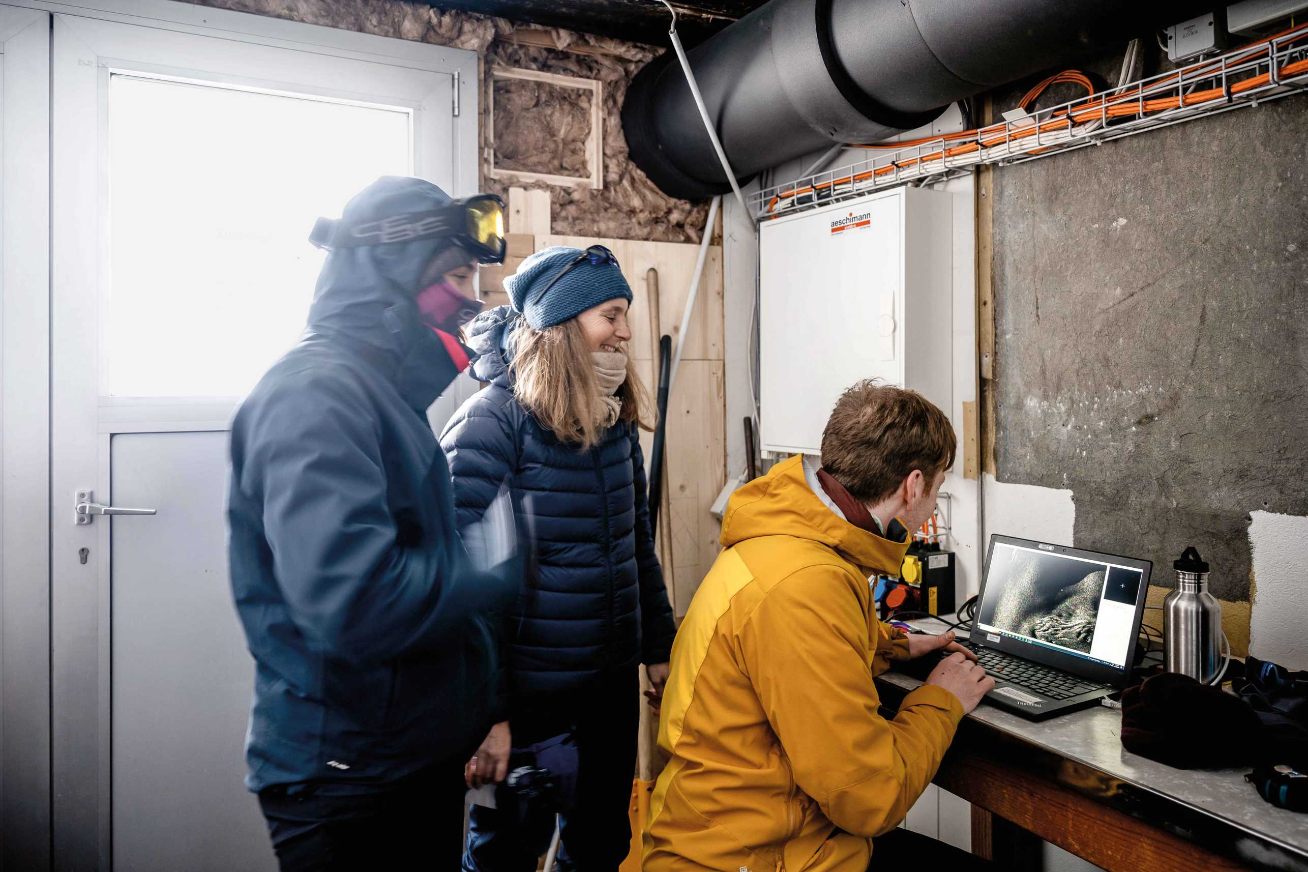
Back in their improvised control room, Hajnsek and Mas i Sanz look over Štefko’s shoulder as he opens the laptop. He is eager to find out whether the incoming data is usable. Massaging his frozen fingers, he types in a few commands and opens what looks like a medical ultrasound image.
The screen shows patches of black and white as well as fuzzy areas with isolated coloured pixels. “That’s a crevasse in the glacier,” says Štefko, pointing to a furrow. “The black area is the radar shadow, and the white area is where the beam is strongly reflected, which is why it’s so bright.” The grey zones indicate where the snow, in line with its specific characteristics, is reflecting the radar beams.
Performing a detailed study of the cryosphere around the Jungfraujoch is not the only goal of this radar project. The scientists also use the data they collect on the ground to support and improve radar remote sensing from satellites.
-
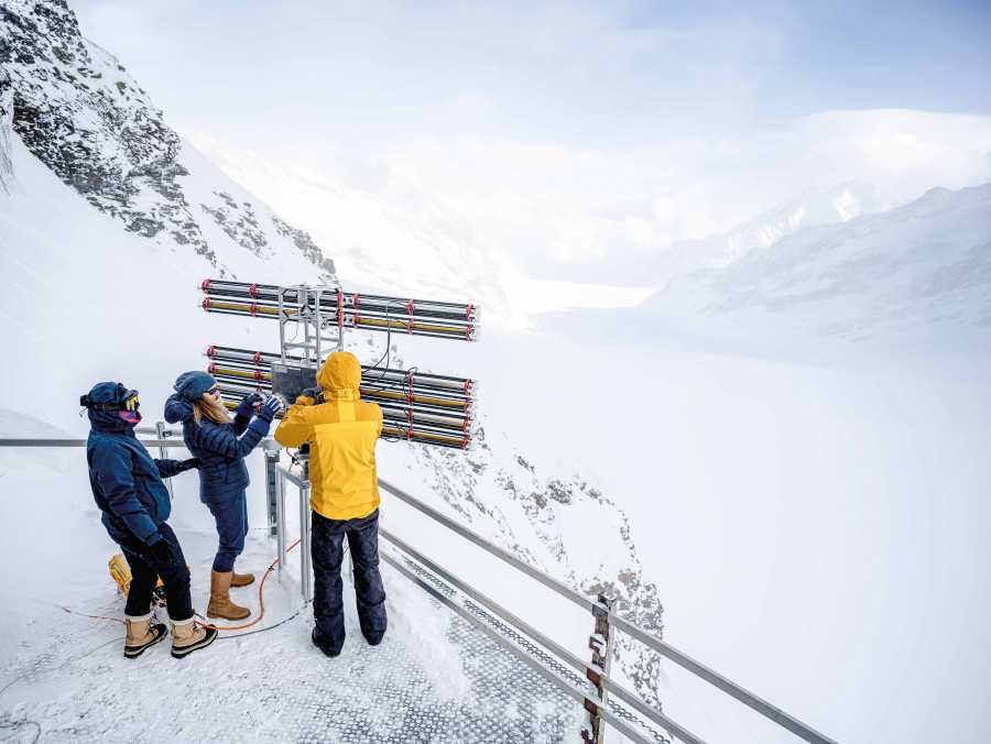
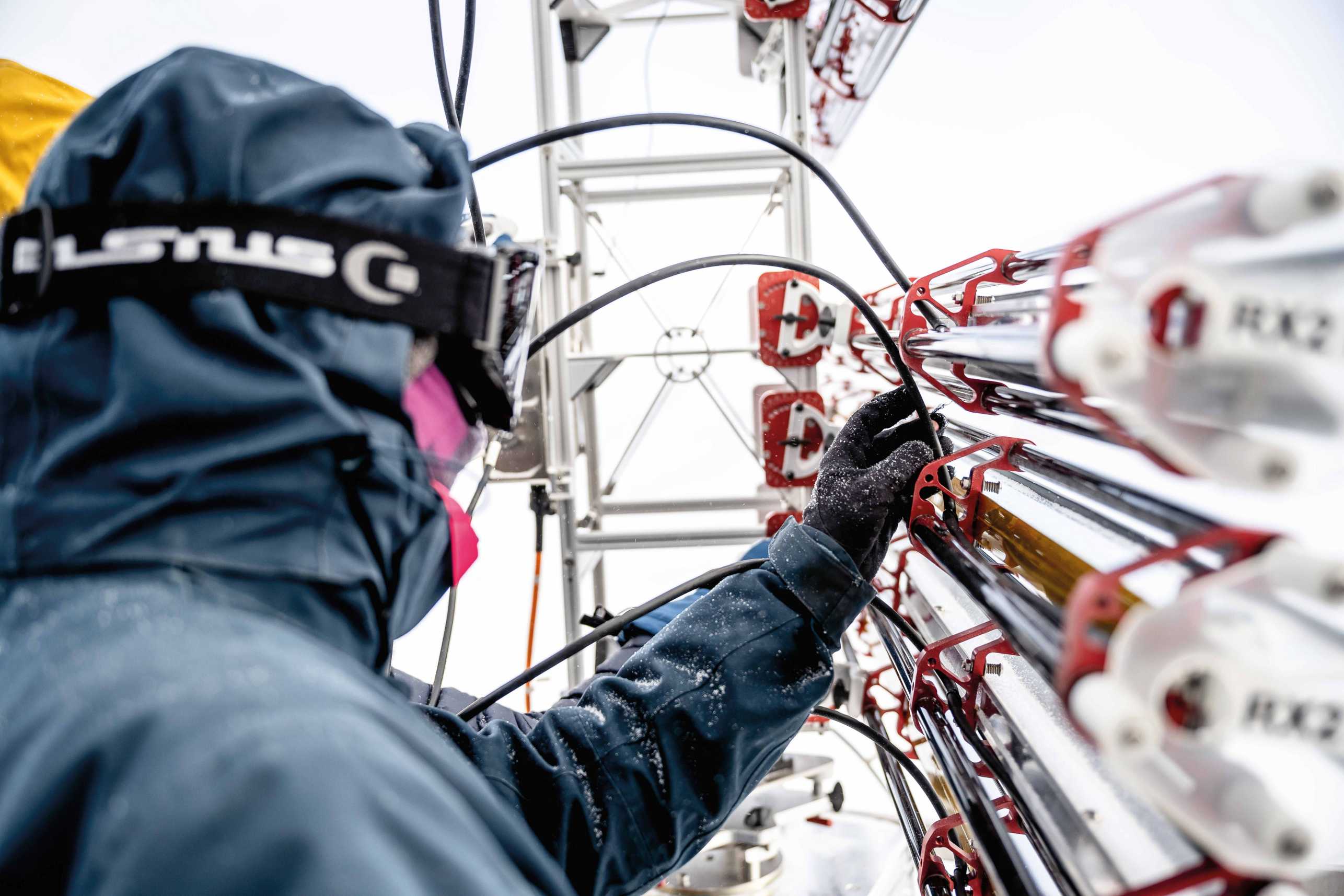
The second radar, equipped with narrow beam antennas, has a clear view over the Aletsch Glacier. (Photograph: ETH Zurich / Daniel Winkler) -
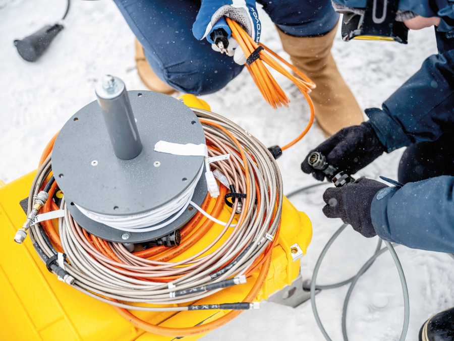
Many metres of cable are required to connect the radar antennas to the computer. (Photograph: ETH Zurich / Daniel Winkler)
It was Hajnsek who forged this connection to satellite remote sensing. She is currently helping to design and plan a number of European radar missions, and is still responsible for the science coordination of the TanDEM-X mission, operated by the German Aerospace Center (DLR). The objective of this mission was to generate a high-resolution topographic map of all of Earth’s land surface using radar measurements. The DLR launched the first mission satellite in 2007, and the second three years later.
The twin satellites – each of which is equipped with a radar system – fly in a helix-like formation as they orbit the Earth. Experts refer to this as bistatic radar configuration, and the data it provides has enabled DLR researchers to create three-dimensional digital elevation models in high resolution.
Although TanDEM-X has long since achieved its objective, the mission is still operational. The twin satellites continue to orbit the Earth, detecting changes in land use, such as deforestation. Once every 11 days, TanDEM-X also passes over the Jungfrau region, which features on the DLR’s list of “super test sites”. The aim is to take regular measurements over the course of several years and thereby record the development of these rapidly evolving areas.
Over the past few years, Hajnsek and her colleagues have developed a ground-based radar system called KAPRI, which simulates the bistatic radar configuration of TanDEM-X and provides new data that will help scientists prepare for future bistatic missions.
“The ground-based radar is a quick method of gathering a lot of data on a specific area and can be set up almost anywhere, just as long as the location is elevated,” she explains. One downside, she acknowledges, is that the radar system can only cover a small area, while satellite radars span the entire Earth. “But because we know exactly what we’re looking for with our radar systems, it’s easier for us to interpret the data we collect and to assign it accurately to a specific part of the Earth’s surface. That, in turn, helps us do a better job of interpreting the data we get from space,” she says.
Perfect test site
It’s taken the three researchers over an hour to set up the two radar systems on each terrace. Hajnsek is standing next to the radar system on the lower terrace, protected from the elements by glacier goggles, thick gloves and sheepskin-lined winter boots. Stretching out her arms, she marks out 60 degrees of a circle: “This is the section of terrain the radar will capture,” she says.
The view from here encompasses much of the upper part of the Aletsch Glacier and continues far beyond Konkordiaplatz, where four fingers of the glacier meet. Conducting research here would be impossible without access to the superb infrastructure of the High Altitude Research Station. It provides everything the scientists need, including a reliable power supply from Jungfrau Railways, Wi-Fi, comfortable lodgings with a fully equipped kitchen and an unobstructed view of the glacier. The researchers also have direct access to the glacier through a tunnel, which allows them to collect snow and ice samples and to set up corner reflectors, which are used to calibrate the radar systems.
“The Jungfraujoch is the perfect test environment for our project – we’re very lucky to have all this infrastructure at our disposal,” says Hajnsek, clearly grateful for all the support she and her colleagues have received from the High Altitude Research Station Jungfraujoch.
Mobile ground-based radar
The sun has finally broken through and dispelled most of the clouds; the thermometer, however, remains stubbornly at minus 12 degrees Celsius, and the icy wind blows unabated. Štefko has dismantled one of the beam antennas and is now carrying it carefully back to the storeroom next to the control room. “The rule is that we dismantle the radar antennas 40 minutes before sunset,” he says. Undoing the delicate retaining screws requires him to remove his gloves, so there’s no escaping cold fingers.
Štefko and Mas i Sanz will stay up here for another ten days to take further measurements before the spring campaign comes to an end in mid-March. The next campaign is scheduled to start in the summer. Štefko has developed a new configuration of the system, which involves one of the two radars moving slowly along a rail from right to left. This simulates the relative motion of the two TanDEM-X satellites. As they move along their orbits, the varying distance between them has a major influence on the radar signals received. The researchers aim to usetheir rail-based radar to reveal how significant this effect is.
During the March measurement campaign, they assembled and tested the system on several occasions. But the snow and cold posed some unexpected challenges. “The equipment we’re using isn’t designed for such harsh conditions. We had to carry out some technical modifications to get it working up here,” says Štefko. “We’re steadily improving the technology, and our next task is to process and analyse the data to find out which direction our next measurements should take.” The ETH researchers are determined to unravel the secrets of the cryosphere that have so far eluded the radar’s view – and they will continue to scale these icy peaks until they do so.
Globe Full speed ahead!

This text appeared in the 24/02 issue of the ETH magazine Globe.
Download Read whole issue (PDF, 7.7 MB)
Comments
No comments yet